File:Rock Carving on Tung Lung Island.JPG

Original file(3,840 × 2,160 pixels, file size: 4 MB, MIME type: image/jpeg)

This file is from Wikimedia Commons and may be used by other projects. The description on its file description page there is shown below.

Description
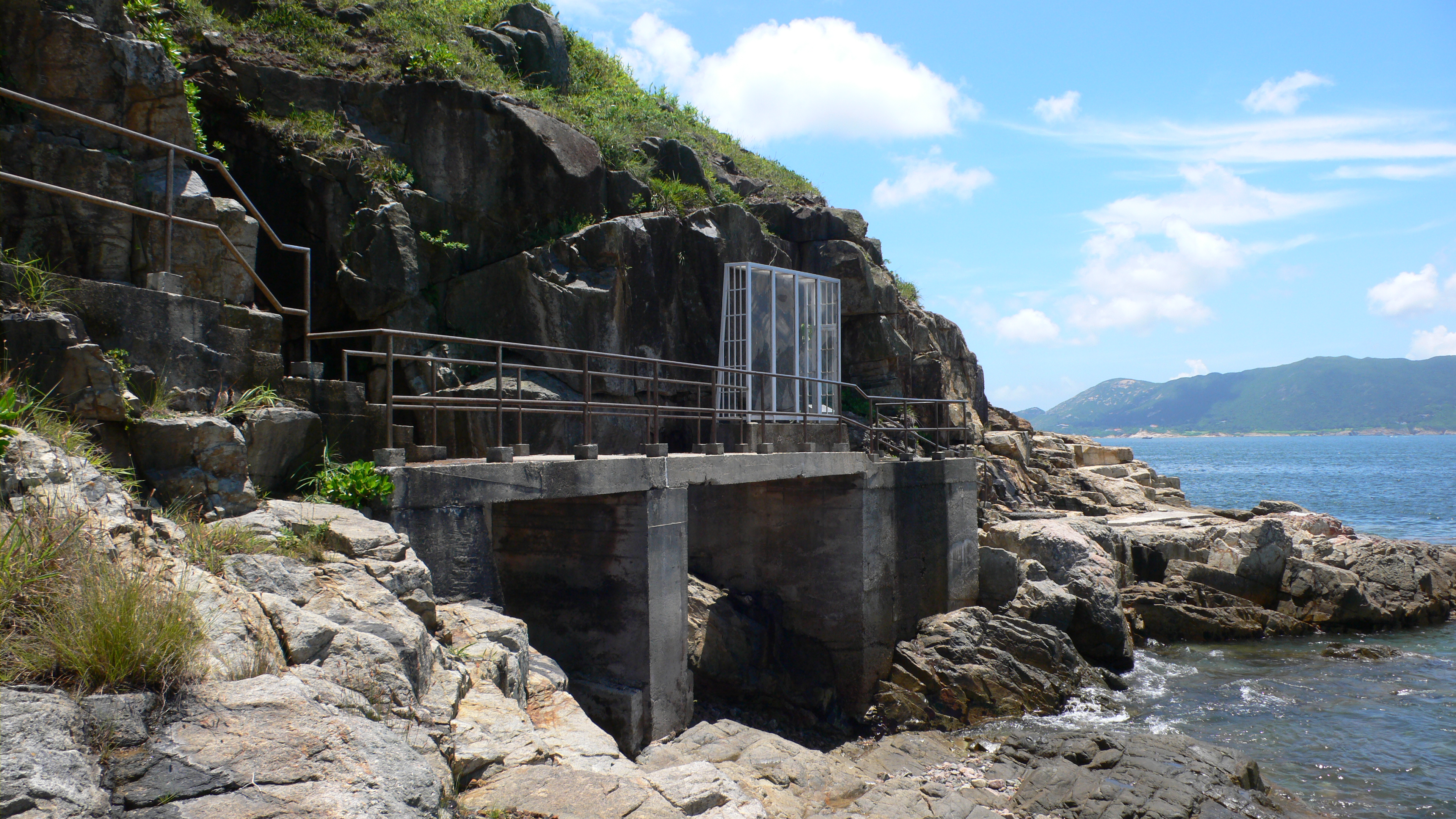
English: On the outlying island Tung Lung Chau at the east of Hong Kong, there is a rock carving which is declared as a historical monument.
中文:'香港東部的一個離島——東龍洲上的石刻是一個法定古蹟
Date 15/07/2007 (uploaded on 17/07/2007)
Source Isaac Wong (惡德神父)
Author Isaac Wong (惡德神父)
Permission
(Reusing this file)
I, the copyright holder of this work, hereby publish it under the following licenses:
GNU head Permission is granted to copy, distribute and/or modify this document under the terms of the GNU Free Documentation License, Version 1.2 or any later version published by the Free Software Foundation; with no Invariant Sections, no Front-Cover Texts, and no Back-Cover Texts. A copy of the license is included in the section entitled GNU Free Documentation License.
w:en:Creative Commons
attribution share alike
This file is licensed under the Creative Commons Attribution-Share Alike 3.0 Unported license.
You are free:
  • to share – to copy, distribute and transmit the work
  • to remix – to adapt the work
Under the following conditions:
  • attribution – You must give appropriate credit, provide a link to the license, and indicate if changes were made. You may do so in any reasonable manner, but not in any way that suggests the licensor endorses you or your use.
  • share alike – If you remix, transform, or build upon the material, you must distribute your contributions under the same or compatible license as the original.
This licensing tag was added to this file as part of the GFDL licensing update.
w:en:Creative Commons
attribution share alike
This file is licensed under the Creative Commons Attribution-Share Alike 2.5 Generic, 2.0 Generic and 1.0 Generic license.
You are free:
  • to share – to copy, distribute and transmit the work
  • to remix – to adapt the work
Under the following conditions:
  • attribution – You must give appropriate credit, provide a link to the license, and indicate if changes were made. You may do so in any reasonable manner, but not in any way that suggests the licensor endorses you or your use.
  • share alike – If you remix, transform, or build upon the material, you must distribute your contributions under the same or compatible license as the original.
You may select the license of your choice.
Other versions a bigger version in creator's PC
Camera location22° 15′ 10.57″ N, 114° 16′ 58.87″ E Kartographer map based on OpenStreetMap.View this and other nearby images on: OpenStreetMapinfo

Captions

Add a one-line explanation of what this file represents

Items portrayed in this file

depicts

22°15'10.573"N, 114°16'58.872"E

0.002 second

6.7 millimetre

image/jpeg

File history

Click on a date/time to view the file as it appeared at that time.

Date/TimeThumbnailDimensionsUserComment
current16:15, 17 July 2007Thumbnail for version as of 16:15, 17 July 20073,840 × 2,160 (4 MB)Father vice{{Information |Description= '''en:'''On the outlying island Tung Lung Chau at the east of Hong Kong, there is a rock carving which is declared as a historical monument.<br>'''zh:'''香港東部的一個離島——東龍洲上的可刻是一個法定古�

The following page uses this file:

Metadata