File:Paraguay regions map.png
Size of this preview: 542 × 600 pixels. Other resolutions: 217 × 240 pixels | 434 × 480 pixels | 694 × 768 pixels | 925 × 1,024 pixels | 2,347 × 2,597 pixels.
Original file (2,347 × 2,597 pixels, file size: 936 KB, MIME type: image/png)
Summary
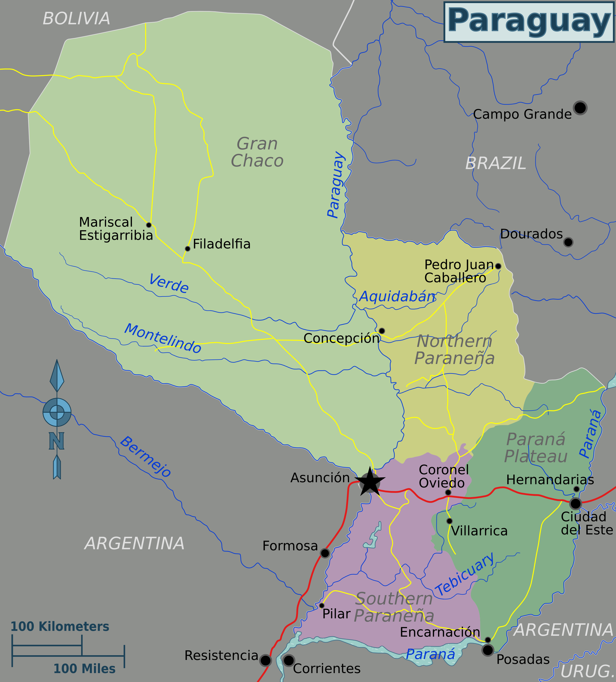
| Description | Paraguay regions map for use on Wikivoyage, English version | ||||
| Date | |||||
| Source |
Own work based on
|
||||
| Author | Peter Fitzgerald, amendments by Joelf | ||||
| Other versions |
.png)
Licensing
This file is licensed under the Creative Commons Attribution 3.0 Unported license.
- You are free:
- to share – to copy, distribute and transmit the work
- to remix – to adapt the work
- Under the following conditions:
- attribution – You must give appropriate credit, provide a link to the license, and indicate if changes were made. You may do so in any reasonable manner, but not in any way that suggests the licensor endorses you or your use.
Original upload log
| This file was imported from Wikivoyage WTS. |
The original description page was here. All following user names refer to wts.wikivoyage-old.
- 2010-01-21 04:00 (WT-shared) Peterfitzgerald archive copy at the Wayback Machine 2349×2600 (938602 bytes) == Summary == {{Imagecredit|credit=Peter Fitzgerald|captureDate=20 January 2010|location=Paraguay|source=[[:Image:Paraguay regions map.svg]] (Import from wikitravel.org/shared)
- 2010-01-22 17:55 (WT-shared) Peterfitzgerald archive copy at the Wayback Machine 2349×2600 (952410 bytes) (Import from wikitravel.org/shared)
- 2011-08-09 06:26 (WT-shared) Joelf[dead link] 2347×2597 (958121 bytes) Added Filadelfia plus minor corrections. (Import from wikitravel.org/shared)
File history
Click on a date/time to view the file as it appeared at that time.
| Date/Time | Thumbnail | Dimensions | User | Comment | |
|---|---|---|---|---|---|
| current | 16:19, 23 December 2012 | | 2,347 × 2,597 (936 KB) | OgreBot | (BOT): Reverting to most recent version before archival |
File usage
The following page uses this file: